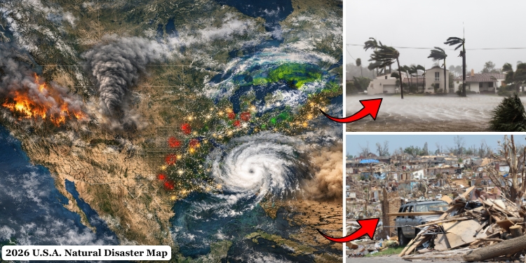
Millions of Americans live in areas where the risk of major natural disasters is increasing, according to new projections for 2026. In the Atlantic and the Gulf of America, hurricanes are strengthening more quickly than before.
In the western states, wildfire seasons continue to spread and last longer. Large parts of the central US also face repeated waves of severe storms. At the same time, long-known threats such as earthquakes remain a serious concern in several regions.
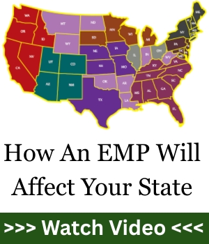
If you are in a hurry, watch our YouTube clip about the subject below but remember that more important information is available in the following paragraphs:
The Data Shows a Troubling Trend
The scale of these threats becomes clearer when looking at long-term disaster statistics. According to the NOAA, the United States has experienced more than 400 separate weather and climate disasters that each caused at least $1 billion in damage since 1980. Even more striking is how those disasters are distributed over time. Nearly three quarters of them occurred after the year 2000, showing that extreme weather events are becoming more and more frequent.
The financial impact is staggering. Between 1980 and 2023 alone, these disasters caused over $2.7 trillion in total damage across the country. Hurricanes account for the largest share of those losses, followed by severe storms, droughts, wildfires, and flooding.
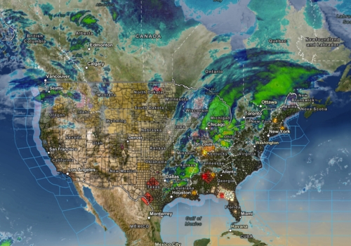
To better understand how these threats are distributed across the country, it helps to look at this U.S. Severe Weather Map that tracks ongoing storms, floods, and other major weather hazards across the country in real time.
Another layer of risk becomes visible when looking at where people live today. FEMA’s National Risk Index estimates that over 60 million Americans now live in counties facing high disaster risk, meaning those communities are exposed to multiple natural hazards at once. In some cases, the same area may face hurricanes, flooding, and extreme storms within the same year.
Because of this overlap, the map of potential disaster zones is becoming more complex. Coastal states deal with storms and rising water levels. The western states struggle with drought and wildfire conditions, while the Central states face violent thunderstorms capable of producing tornadoes and flash floods.
Wildfires – A Growing Threat Across the Western U.S.
 Wildfires have always been part of the western ecosystem, but the scale of recent fire seasons shows how dramatically conditions have changed. Drought cycles, hotter temperatures, and earlier snowmelt have created forests filled with dry vegetation that burns easily once a fire starts.
In the past, wildfire seasons typically lasted a few months during the hottest part of the summer. Today, in many western states, fire season begins earlier and stretches well into the fall. Some experts even describe the situation as a near year-round risk in certain regions.
According to the National Interagency Fire Center, our country averages around 60,000 wildfires each year, burning between 7 and 8 million acres of land annually. During particularly severe seasons, those numbers can climb even higher.
California remains the state most associated with devastating fires, yet the risk extends far beyond its borders. Oregon, Washington, Arizona, Nevada, and parts of New Mexico and Idaho have all experienced increasingly destructive wildfire seasons over the last decade.
One reason wildfires cause such heavy damage today is the expansion of housing into forested regions. Researchers call this area the wildland-urban interface, where neighborhoods sit directly beside dense vegetation. In these zones, a wildfire can quickly move from forest to homes, sometimes destroying entire communities in a matter of hours.
Another factor is wind. Under the right conditions, powerful winds can carry embers miles ahead of a fire front. These embers ignite new fires far beyond the original blaze, making containment extremely difficult.
The consequences extend beyond burned homes and forests. Wildfire smoke can spread across multiple states, creating dangerous air quality conditions that affect millions of people. Hospitals often report spikes in respiratory illnesses during major fire events. Because wildfire conditions can escalate quickly, communities located in western fire corridors often face rapid evacuation orders with little warning.
The Most Expensive Disasters in the Country
 The Atlantic hurricane season officially runs from June through November, yet the most powerful storms often form during the late summer and early fall.
Warm ocean water acts as fuel for hurricanes, allowing them to grow stronger as they move across the Atlantic or Gulf of America.
Meteorologists studying ocean temperatures have noticed an important trend: hurricanes are strengthening faster than they did in the past.
A storm that once took several days to develop into a major hurricane can now intensify within a single day under the right conditions.
Forecast models for active hurricane seasons typically predict between 13 and 19 named storms, with 6 to 10 becoming hurricanes and several reaching major hurricane strength.
The areas most exposed to hurricane damage include:
- Florida – Miami, Tampa, Fort Myers, Jacksonville, and the Florida Keys remain among the most hurricane-exposed locations in the country. Much of southern Florida sits only a few feet above sea level, which makes storm surge especially dangerous.
- Texas – Houston, Galveston, Corpus Christi, and Port Arthur frequently sit in the path of storms forming in the Gulf of Mexico. Houston in particular faces major flooding risks because of its flat terrain and dense urban development.
- Louisiana – New Orleans, Lake Charles, and Baton Rouge remain highly vulnerable to both hurricanes and storm surge. Large portions of southern Louisiana sit below sea level, which makes flooding one of the biggest concerns during major storms.
- Mississippi – Gulfport, Biloxi, and Pascagoula lie directly along the Mississippi Gulf Coast, where hurricanes moving inland from the Gulf can bring powerful winds and coastal flooding.
- Alabama – Mobile and the surrounding Gulf Coast region face repeated hurricane threats due to their location along the northern Gulf shoreline.
- North Carolina – Wilmington, the Outer Banks, and coastal communities along Cape Hatteras are often exposed to Atlantic hurricanes moving up the East Coast.
- South Carolina – Charleston, Myrtle Beach, and Hilton Head Island remain some of the most exposed areas because storms traveling north along the Atlantic frequently make landfall or pass very close to the coastline.
These states sit along the Gulf of America or the Atlantic coastline, placing them directly in the path of storms forming over warm water. Even so, the most dangerous aspect of hurricanes is not always the wind itself. In many cases, flooding and storm surge cause the majority of damage. Storm surge occurs when powerful winds push seawater inland, flooding coastal communities sometimes several miles from the shoreline.
Also, large hurricanes can produce extreme rainfall far inland. Rivers overflow, urban drainage systems fail, and entire neighborhoods can remain underwater long after the storm passes.
History already shows how destructive these disasters can become. Hurricanes like Katrina, Harvey, and Ian caused tens of billions of dollars in damage and forced hundreds of thousands of residents to leave their homes.
The Ever-Present Risk Along Major Fault Lines
Two regions in the U.S. face the greatest earthquake risk.
The first is California, where the San Andreas Fault runs through large portions of the state. This fault marks the boundary between two tectonic plates that slowly grind past one another.
The second major risk area lies in the Pacific Northwest, where the Cascadia Subduction Zone sits offshore from Washington and Oregon. Scientists believe this fault is capable of producing extremely powerful earthquakes, potentially followed by tsunami waves along the coast.
2026 U.S. Earthquake Map. Is Your State in the Danger Zone?
Urban areas such as Los Angeles, San Francisco, Seattle, and Portland contain millions of residents living near major fault systems. Because earthquakes strike without warning, emergency planners focus heavily on structural safety and disaster response planning. In this case, you should follow the Urban Survival Protocol to get through the critical period after an earthquake.
While earthquakes occur less frequently than storms or floods, their potential impact is enormous. A powerful earthquake striking a large city could damage transportation systems, electrical grids, pipelines, and communication networks – all at once.
That’s why experts advise people who live in earthquake-prone areas to keep a backup generator, store a reliable water supply and water filters (H20 or Aqua Tower), and maintain at least two weeks of food at home while services are disrupted.
Tornado Outbreaks Across the Central U.S.
 Tornadoes remain one of the most violent and unpredictable natural disasters in North America.
Unlike hurricanes, which can be tracked days before landfall, tornadoes often develop with very little warning.
Most tornadoes form during severe thunderstorms when warm, humid air collides with cooler air masses.
These collisions create unstable atmospheric conditions capable of producing rotating columns of wind that extend from storm clouds to the ground.
The central of the country has long been known as Tornado Alley, a region where these conditions occur frequently. States most commonly affected include:
- Oklahoma – Oklahoma City, Norman, and Moore sit in one of the most active tornado corridors in the country. Moore in particular has experienced multiple devastating tornadoes over the past few decades.
- Kansas – Wichita, Dodge City, and Topeka are located in areas where powerful spring storms regularly develop across the plains.
- Texas – Dallas–Fort Worth, Lubbock, Amarillo, and areas across northern Texas frequently experience severe storm outbreaks capable of producing tornadoes.
- Nebraska – Omaha, Lincoln, and much of eastern Nebraska often see tornado activity as storms move northeast across the plains.
- Missouri – Kansas City, Springfield, and Joplin lie in regions where storm systems traveling from the plains often intensify. Joplin was the site of one of the deadliest tornadoes in modern U.S. history.
- Arkansas – Little Rock, Jonesboro, and much of northeastern Arkansas regularly face severe thunderstorms that can produce tornadoes during spring and early summer.
In recent years, however, meteorologists have observed a gradual shift eastward in tornado activity. Areas in Tennessee, Kentucky, Mississippi, and parts of Illinois are seeing more tornado events than in previous decades.
The destructive potential of tornado outbreaks becomes clear when examining major events. During one severe outbreak in 2025, more than 100 tornadoes formed over several days, leaving dozens of people dead and causing billions of dollars in damage. The most powerful tornadoes, rated EF-4 or EF-5 on the Enhanced Fujita scale, can produce winds exceeding 200 miles per hour. At that strength, entire neighborhoods can be flattened in minutes.
If you live in a high-risk area, it’s worth having a real place to take shelter right at home. Many preppers are now building underground bunkers on their own property using a method that has already been tested and used by thousands of Americans.
We tried it ourselves and were surprised by how solid and practical it turned out. When a tornado tears through an area, an underground bunker like this can protect you from the winds and flying debris. See the step-by-step guide here.
The Most Widespread Natural Disaster
Flooding occurs in nearly every region of the United States and remains the most common natural disaster nationwide. It can happen for several reasons.
Heavy rainfall may overwhelm drainage systems, rivers can overflow after storms, and hurricanes often push water inland through storm surge.
Midwestern states located near large river systems face some of the highest flood risk in the country. Rivers such as the Mississippi and Missouri drain huge portions of the continent, meaning heavy rainfall hundreds of miles away can eventually affect downstream communities.
 Floodwaters may rise slowly over several hours or days, yet once homes are submerged the damage can be extensive. Electrical systems fail, structural materials weaken, and mold begins spreading within days.
Another dangerous type of flood is the flash flood, which occurs when sudden storms drop large amounts of rain in a short time. These floods can fill streets, basements, and low-lying areas within minutes.
According to official reports, floods are responsible for more property damage in the United States than any other type of natural disaster.
Because I grew up along the Mississippi River in Louisiana, flooding was just a part of life. Every year the water would rise, roads would disappear, and anything stored the wrong way would be ruined. That’s why protecting food and supplies from floodwater was something I learned early.
Over the years, a lot of prepper readers have asked me the same question: If a flood hits, will your stockpile survive? From my own experience, the answer is yes, it absolutely can. But only if you do one simple thing most people never think about.
I could try to explain it here, but a friend of mine made a short video that shows the method much better than I ever could. Click here to watch the video.
How to Prepare Depending on the Disaster
Different disasters create different problems. Some destroy infrastructure instantly, while others leave communities without power, water, or emergency services for days or even weeks. Because of that, preparation should match the threat most common in your region.
Floods
Floods destroy supplies quickly if they are not stored properly. Water contamination is also a major issue once floodwaters enter homes and communities. If you live in an area that often floods, keep these things in mind:
- Store food and emergency gear on higher shelves or upper floors to prevent water damage.
- Keep important documents sealed in Mylar Bags or other waterproof containers.
- Maintain water filtration systems or purification tablets, since floodwaters often contaminate drinking water supplies.
- Prepare sandbags or water barriers if your area floods regularly.
- Keep a 3D portable generator ready for when the grid is down.
- Have evacuation supplies prepared in case authorities order residents to move quickly.
Hurricanes
Hurricanes often leave communities without electricity, fuel, and clean water for extended periods. In some major storms, outages have lasted one to three weeks. Here’s what you should do:
- Store at least 100 gallons of drinking water and enough food that does not require refrigeration.
- Fill fuel containers early because gas stations often run dry before storms arrive.
- Reinforce windows and doors with storm shutters or plywood if high winds are expected.
- Keep backup cooking methods such as propane stoves or outdoor grills. For more advice on the best options, check out this article.
- Charge all power banks and radios before the storm arrives.
- If you live in a coastal storm surge zone, bugging-out might be safer than waiting.
Wildfires
Wildfires move quickly and often force people to evacuate with little notice. The goal is to reduce fire risk around the home while also preparing to leave immediately if conditions worsen. Protect yourself and your family by following these safety guidelines:
- Create defensible space by clearing dry vegetation, wood piles, and debris around your home.
- Store N95 masks or respirators, since wildfire smoke can become dangerous even far from the flames.
- Keep bug-out bags ready with essential supplies, documents, and medications.
- Maintain a vehicle with a full fuel tank, because evacuation traffic often creates long delays.
- Keep a modular power station and emergency radios ready, since wildfires often damage electrical infrastructure.
- Monitor local fire alerts and weather conditions during hot and windy periods.
Tornadoes
Tornadoes form quickly, which means the most important preparation involves immediate shelter and short-term survival after the storm:
- Identify the safest location in your home such as a basement or interior room without windows.
- Store helmets, blankets, and emergency supplies in your shelter area to protect against debris.
- Learn ahead of time how to communicate during a blackout – something tornadoes often cause. A small battery power station can keep phones and radios running if power lines are destroyed.
- Keep water, flashlights, and these essential 7 first aid supplies in the shelter since homes may be heavily damaged after a tornado.
Earthquakes
When it comes to earthquakes, the biggest dangers usually come from collapsing furniture, broken utilities, and disrupted infrastructure. So, before a disaster strikes, make sure you:
- Secure heavy furniture, water heaters, shelves, and appliances so they cannot fall during shaking.
- Store at least two weeks of water (one gallon per person per day). If you don’t have space to store that much water, then you should try this device – it’s called Water Freedom System and it was created especially for crisis situations such as floods.
- Keep shelf-stable food that requires little cooking, because gas lines may be shut off after the quake.
- Maintain backup lighting, radios, and battery banks in case power grids fail. Also, there’s an ingenious way to charge your phone with no electricity. Check the step-by-step guide here.
- Keep sturdy shoes, gloves, and flashlights near your bed since broken glass and debris are common after a quake.
- A solar generator can keep communication devices and medical equipment running when the grid goes down.
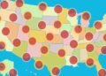
The Map Is a Warning, Not a Prediction
Disaster maps do not predict the exact location or timing of future events. Instead, they reveal where conditions are becoming more dangerous over time.
The data behind the 2026 outlook shows that millions of Americans now live in regions where multiple disaster risks overlap. A coastal city might face hurricanes, flooding, and extreme storms. A western town might deal with drought, heat waves, and wildfire conditions.
As population growth continues in vulnerable areas, the potential consequences of these disasters become even greater.
Also, it’s worth mentioning that all disasters have one thing in common: they eventually shut down the grid. Floods, hurricanes, wildfires, and earthquakes regularly leave entire regions without electricity for days. During those moments, power stops being a convenience and turns into something people desperately try to get back.
The Moray Generator focuses on one simple idea: giving you a way to produce electricity yourself. The guide walks you through how to assemble a small generator from basic components, so you have a source of power when the grid fails.
Take a few minutes to see how the Moray Generator works and why many people are learning how to build one before the next major blackout.
You may also like:

How to Filter Water Using a Sandwich Bag (VIDEO)
6 Ingenious Ways to Communicate Post‑SHTF (It’s Not HAM Radio)
Digital Security Prepping: The Complete Guide to Protecting Your Life Online


Excellent Article
History
Use the historical Data to see exactly where
again : preparation , preparation , preparation
Key to success is to always be on guard for the next disaster
one thing is for sure , there will always be turmoil and troubles
The battle is for the souls of mankind , nothing else ( spiritual , Not physical )
Two things come to mind : Hardship , Blessings , Peace or insecurity
When you put your trust in Jesus Christ , you know where and when it will end
when you do not , then it is a daily fear of the unknown
Jesus Said you shall know the truth and the Truth will set you free, Free, Free
as in the bible : the rain falls on the just and the unjust alike
all have gone astray , and rebelled against God , That is Why Jesus Christ came to give peace , calm When the storms of life come and the loss is great
When our Trust is in the one who can save the soul , there is no fear , Just peace
you can know , when you invite Jesus Christ to be your lord and savior and put your trust in Him . NOT the things of this world
Blessings , Goodness, Love are all from God , Thru Jesus Christ
2 chronicles 7:14 , 1 john , 2 john, 3 john all in the bible , find one , have peace thru disaster s , that you cannot stop , but you can prepare
Appreciate this. Preparation really is the foundation, and you’re right, history shows these events keep coming. Wishing you peace and strength, no matter what comes.
Here, in the rural and forested PNW, the big threats are wildfire and the Cascadia fault. We only have somewhat preventive control over the wildfire aspect. As spring changes into summer the rain gutters are cleared of fir needles and leaves and the roofs are swept of the same “fire tinder”. Roof sprinklers and hoses are readied as are fire tools. In the event of evacuation my last act would be to run the pump house on its dedicated genset to offset possible land line power outage to keep roof sprinklers running. As mentioned in the article, embers can travel many miles on the wind. Again, clean those rain gutters, they hold an awful lot of flammable material next to the edge of asphalt shingles.
As far as the Cascadia fault goes, it will mostly be damage control after the fact. Turning off the main breaker to electricity if needed (our only public utility), but don’t forget gas if you have that and can smell it in the aftermath. The subduction zone quakes, six months later on the Kamchatka peninsula is still producing four and five point quakes. Keep the pantry stocked up, travel could be non existent for a while.
Yeah, this makes a lot of sense. Cleaning the gutters and roof like that is one of those simple things that really works when embers start flying around.
And you’re right about the earthquake too. At that point it’s just dealing with what comes after, so knowing how to shut things off and having food ready is what keeps us going.
While wildfires in the Arizona north, have been concerning … the natural disaster that affects most of the populous of Arizona (surrounded by desert) is drought … that takes years and years of little to no snow, little to no rain, and bad water management. Without water one dies or shrivels up like a raisin.
Shutting down the Grid ?
Apparently, we now have a non Nuke EMP weapon, in use in the Mid East NOW.
When we find out more, we will know how it could change our lives. We have, THEY will now do what ever it takes to get one to use against US
Think big and think 30 steps ahead.
Still live in a city, sorry for you
I think the….THEY……would rather have a nuclear weapon..Live all alone deep in the woods and you are going to get anal probed by spice aliens…..don’t worry… you won’t remember a thing.
It’s the Gulf of America not the Gulf of Mexico so please make a note of it.
You have missed the major reason that wildfires are so severe now. The forest lands are overgrown because “environmentalists” have effectively reduced any activity to reduce the fuel load either through logging or controlled burns. 30 years ago California did a lot of that. Now they do very little. In addition, the US Forest Service policy is to let the fire burn out, rather than suppressing it. But there is far too much fuel load for that to be a sensible policy.
We have had long term (multi year) droughts in California in decades past without catastrophic wildfires because the lands were well managed. This is a bad government problem.
I have said the same thing in past fire articles, for CA fires.
YOU ARE SO RIGHT, its about time they woke up.
You make some valid points, and you haven’t missed much—forest management and fuel load definitely play a role in how severe wildfires can get. It’s a complex issue though, with multiple factors involved, but your perspective on land management is an important part of the discussion.
Million and billion $ disasters are more common now because everything costs more, NOT because of your climate change bullshit!
They are both legitimate causes… Climate change is not bullshit, it’s just misunderstood.
It just quit raining a minute ago! Now the sun is shining! That’s climate change, I guess! We have very little in the way of natural disasters where we live! It can flood in places. That’s about the worst!