When SHTF, your smartphone becomes a paperweight. That GPS app you rely on daily? Gone. Cell towers down, power grid offline, satellites potentially jammed—you’re on your own. In that critical moment, your survival won’t depend on technology. It will depend on how well you know the ground beneath your feet.
In a grid-down scenario, the U.S. Air Force could shut off civilian GPS access, and GPS degradation creates risks that must be considered carefully for emergency navigation. Your neighborhood will transform from familiar territory into a tactical environment where every street corner could mean life or death.
The smartest preppers know that mapping your area isn’t just another item on the prep list—it’s the foundation that makes every other preparation work.
Think Like A Warfighter
 Military units never enter unfamiliar territory blind. Neither should you. Start with the obvious: main arteries in and out of your neighborhood. Which roads connect to highways? Which ones dead-end into subdivisions? More importantly, which will become parking lots when everyone panics at once?
Now dig deeper. Those secondary streets most people ignore could be your lifeline. Service roads, delivery routes, and residential cut-throughs often stay clear when main roads jam up. But here’s what most preppers miss: you need to walk these routes, not just drive them.
On foot, you’ll spot things your car windshield hides. That gap in the fence between two subdivisions. The utility easement that runs behind the strip mall. The storm drain system that could move you unseen across town. These details separate those who escape from those who get trapped.
Pay attention to natural features too. That creek behind your house isn’t just scenery—it’s either a barrier or a corridor, depending on the situation. Hills provide cover and observation points. Dense woods can hide you or slow you down. In normal times, terrain is background. In survival mode, it’s everything.
Build Multiple Escape Plans
Here’s a hard truth: if you’ve only planned one way out, you haven’t planned at all. Officials recommend knowing where to go if asked to evacuate quickly and how your family will get there. But what happens when “official” evacuation routes become death traps?
You need minimum three escape routes: two vehicular and one on foot. Your driving routes should prioritize back roads and avoid major intersections. Yes, they take longer in normal conditions. But when highways become parking lots, those winding residential streets may be the only roads still moving.
>> This Underground Bunker Will Keep You Safe In Case of An EMP Strike
Your foot route requires different thinking entirely. Look for paths vehicles can’t access: walking trails, railroad tracks, utility corridors, even large drainage ditches. Practice these routes in daylight and darkness. Know where you’ll have cover and where you’ll be exposed. Time yourself—panic makes people move slower, not faster.
Study chokepoints religiously. Bridges, tunnels, and narrow intersections are where crowds pile up and control is easily imposed. Smart route planning minimizes dependence on these bottlenecks. If you must use them, have alternatives ready.
Establish Rally Points That Work
 Family separation is almost guaranteed in a fast-breaking crisis. Dad’s at work, kids at school, mom running errands—then everything goes sideways simultaneously. Making a family communication plan is critical, but phones die and cell towers fail.
Choose two meeting points. The first should be close and obvious: that big oak tree in the neighborhood park, the church everyone knows, or the corner where three streets meet. This is your immediate rally point—somewhere family members can reach quickly without vehicles if necessary.
Your secondary meeting point needs to be further out and more discreet. Think like a guerrilla: a quiet corner of a parking lot on the town’s edge, an abandoned barn, or a distinctive landmark away from main roads. This backup location keeps you from clustering with desperate crowds at obvious gathering spots.
Everyone in your household needs to memorize both locations and practice reaching them without electronic assistance. Run drills. Make it routine. When chaos hits, muscle memory and practiced routes save lives.
Pre-Position Critical Resources
Sometimes the smartest move is just going to ground temporarily. Identify concealed locations where you could shelter for hours or even overnight: thick wooded lots, covered drainage areas, the blind side of industrial buildings. Avoid anywhere people naturally gather.
These same spots work perfectly for supply caches. A waterproof container buried with water purification tablets, emergency food, copies of important documents, and a hand-crank radio could mean the difference between making it and not. Just remember: discretion is everything. Obvious hiding spots attract attention.
Rotate cached supplies regularly. Energy bars go bad, documents become outdated, and batteries leak. Mark refresh dates on your prep calendar and treat cache maintenance like any other critical system.
Alternatively, you can learn here what the main components of a portable water generator are—one that you can rely on when SHTF. It’s very similar to The Water Freedom System, which is the perfect water generator for bugging in.
If you also want a reliable backup option for when you’re away from home—so you don’t risk running out of water—I recommend the water generator that fits in a backpack. It was designed based on plans originally developed by U.S. Military Intelligence experts and only recently revealed to the public.
Easy to assemble, compact, and capable of producing dozens of gallons of water straight out of thin air, this is the solution you need. Click here to learn more!
Develop Intelligence Gathering Points
Information wins fights. If you can see what’s happening while staying invisible, you gain time and options others don’t have. Scout elevated positions around your area: rooftops, hills, second-story windows, even sturdy trees with good sight lines.
From these observation posts, you can monitor road conditions, track group movements, or confirm whether a route is safe before committing. Practice reaching these spots quietly—know the approaches and potential escape routes from each one.
But remember: if you can spot good observation posts, so can others. Map where enemies might watch from too. Smart preppers think like both the hunter and the hunted.
Map Local Assets and Threats
 Your neighborhood contains more survival resources than you realize—and more dangers too.
- Water sources: streams, retention ponds, even decorative fountains can provide emergency water. Always plan to filter and purify. But remember: water sources also attract crowds and potential conflict.
- Shelter materials: construction sites, hardware stores, even abandoned buildings may contain useful materials. Just know that others will have the same idea.
- Government facilities: these might distribute supplies initially, then become fortified control points. Schools, fire stations, and government buildings are tactical wildcards.
- Potential trouble spots: gas stations, liquor stores, pharmacies, and gun shops become magnets for desperate people and law enforcement activity. Major intersections and shopping centers turn into friction points quickly.
Create Your Tactical Map
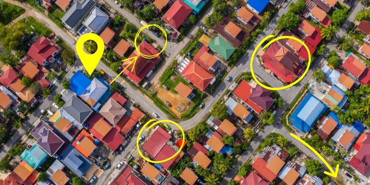
All this intelligence means nothing unless you organize it into something usable under stress. Paper maps remain the gold standard—they don’t need batteries, can’t be hacked, and work when everything else fails.
Start with a detailed street map of your area. Add your observations using a color-coding system: green for safe zones, red for danger areas, blue for water sources, yellow for cache locations. Use simple symbols anyone in your family can read quickly: stars for rally points, arrows for escape routes, triangles for observation posts.
Laminate the map or seal it in a waterproof case. Make copies for every family member’s go-bag. Practice using it regularly—navigate to familiar locations using only the map, even in good times. This builds the skill before you need it desperately.
Be Ready
Escape plans for your neighborhood are very useful. Maps will help you, especially mental ones. It’s ideal to have a clear picture in your head of emergency exits, points of interest, and safe locations.
In the end, the map in your mind is the only one you can’t lose and no one can steal. However, if you end up in a situation where you must leave your home and neighborhood, you’ll need to have other things with you.
Think quickly about the essentials: water and food. For food, I recommend keeping a few protein bars and other lightweight, high-calorie foods in your bug-out bag. Here you can find some good ideas for high-calorie foods to take with you in case of a bug-out.
Also, be prepared to face life in the wilderness. Alone or with your family, you’ll need to know how to:
- Find water
- Find food
- Stay safe from predators
- Build shelter
- Start a fire
From the comfort of your home, these needs may seem hard to imagine right now. But it would be naïve to believe you could never end up in such a situation. If you’ve made it this far reading the article, it’s worth making a solid bug-out plan.
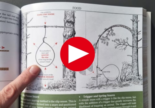
The Wilderness Long-Term Survival Guide is the book I recommend to get you up to speed on everything wilderness survival. Learn everything you need to know. Oh, and keep in mind it’s full of picture guides, which makes it an excellent resource to put in your bug-out bag.
Final Thoughts
Most preppers obsess over gear and supplies while ignoring the ground they’ll need to move across. Don’t make that mistake. Your fancy equipment won’t help if you don’t know where you’re going or how to get there safely.
Start this weekend. Walk your neighborhood with new eyes. Note what’s useful, what’s dangerous, and what everyone else misses. Drive your planned escape routes at different times of day. Find those rally points and make sure everyone knows them. Then put it all on paper. A hand-drawn map with local knowledge beats any GPS when the grid goes down.
If you ever need to escape your neighborhood and retreat into the wilderness, it’s crucial to know in detail what you can and cannot eat in the forest—or anywhere else you might end up. The Forager’s Guide to Wild Foods teaches you exactly what’s safe to eat and how to use it. Get informed here and stay safe!
You may also like:

Amish Survival Hacks that Can Help You Thrive Post-SHTF (Video)
6 Essential Maps to Store Before an EMP
The Map That Shows You The Edible Trees In Your Neighborhood


If you do map out your town or area. Make sure you do it in “gray man”, if I saw you in my area mapping out what is talked about in this article, I would get suspicious.
Be careful also that no one knows you are doing such a thing.
If the local sorry cops find out you just might get a death visit from the murder group. Calling you a terrorist.
Yes that’s how sorry they can and will be.
Remember lose lips sinks ships.
Watch your back, there just waiting to destroy you and your way of life.
AND please, remember, trust NO one.
stay sharp
The advice in the article is good. Some finer points on the technologies are as follows; GPS satellites are “dumb” and robust simply transmitting their location continuously as they all swarm around in orbit. The “smarts” is in the unit you are using, that is where the triangulation and overlaying a map data base occurs. If a lot of satellites are lost then the GPS is not “wrong” but its “accuracy” may be degrade to 1000′ instead of 10′ due to less triangulation. In theory even if all satellites were lost you could still use a GPS unit with embedded map data base (not your cell phone) as an “electronic map” by manually scrolling / panning / zooming for known landmarks (lakes, towns, roads). The data is still there just the “you are here function” is not working. Not a replacement for hard copy maps but good to know in a pinch. Even a very basic handheld cheap hikers GPS with only a couple of satellite pings can give you a longitude and latitude fix with an accuracy of 1000 (1/4 mile) to assist in locating yourself on a hard copy map. Learn to use a compass and a sextant for when a really hard reset occurs.
As a former meteorite hunter ….maps are your best friend…see if your state has a department of natural resources ,Geographic Information System database….which you should be able to purchase very detailed public lands quadrandgle map’s for a few bucks…knowing who’s land you are walking on can be a game changer….life and death game changer….then you can also print up map’s off goggle earth for even more detail . Now you can B. O. if you so disire….note ..i would not get to cocky with real law enforcement personnel…..and U.S. military……etc.
NEVER try to locate much of anything with cell phone NON GPS. Today, try them in any area where cell service is just a little spotty, they dont work.
PAPER MAP ! a Must. ALSO, important areas, like home to go to location LAMINATE them. When SHTF, add good masking tape over area that needs updating and draw on the tape to correct, like bridge GONE. Remember, if its a hot end to the fan, lots of things will be “re arranged”.
Your bug out bag, just enough to get you to where you plan to go, not to last a day longer.
Industrial building back side – working, second place looters will go. not working = KIDS party every sat night, they examine everything, sooner or later. they even bring bolt cutters, NEXT TIME.
your “cache” , you should OWN the ground, or the owner will now own your supplies, sooner or later. I think i am clever, is not the basis for a relocation play. Buy an acre, heck, rent it for 50 yrs paid in advance. Buy a sea container, place it, let the brush grow or even help the brush grow, erasing the trail used to place the box. Hand carry or set up a winch cable trail to get the gear out.
BETTER YET, own land in the greater area, that has woods, open areas (out of site), running water, well hidden from roads ! Plan, wind, water, solar, crops, lots of resources, like growing woods.
buy your states topo maps, a good national atlas, and other states topo maps if travel is in your plan ( I.E. a year after the fan goes down, you might want to move to a warmer area with longer growing season, big water for BIG fishing maybe even ocean access. Where you can live cutting wood for cooking, smoking DEER a major resource! and not to burn 200 lbs a day for heat, 6 months a year)
mapping on foot, best done by a couple, with small day pack, lots of hand holding AND CAUTION, if you get questions apologize and ask for re routing advice, usually they will then Allow you just this once. If map making is needed for foot trip, make them on SMALL note book pages you can pocket effortlessly and instantly, travel quiet so you hear everyone before they hear you. BEST to just live where it wont likely be needed.
Back up bug out from Urban area, rent a storage unit. They will be safe for a day or so while they attack W mart. couple low tech minibikes, fuel and extra fuel, food, water, things you can carry on the bikes to supplement your go bag. Now your vehicle can be replaced. which might be on the wrong side of water, damaged or otherwise stranded, impounded etc. and if not, let them hang out the trunk wile you drive away.
Howdy from high in the desert swamp,
A few summers back I was with a group of teenagers and adults. I told them to buy a compass if you do not have one. I knew this was going to happen so I reenforced buy a compass for navigation class. 35 people and 10 adults did not get one and told me smugly, they would use their phone. I said okay. Get your compass out and wait until the colored needle stops. Turn yourself until the color lines up with N. 27 did perfect. 8 of 10 smug phone using adults faced exactly south. I told everyone to look at these people who would not follow the instructions. If you ever have to be in a situation like this, no electricity, no way to charge the phone when it runs down, it’s oriented backwards and now you have to watch them all the time because they will get lost. Expect them to buck you at all times because quite obviously they know best. Quite obviously they don’t. Oooo the stink eye I got. You will also have to put up with them trashing me because I pointed out they are now a boat anchor in your group. We had squad leaders. A couple of these adults were leaders. Just in case you all forgot about a year ago the surprise hurricane that came through here. Power out, that cell tower was knocked out and trashed. The 5g was overloaded. No cell service for 30 hours. Who wants to replace the phone compass squad leaders? Everyone who counted raised their hand. They were replaced. They were not happy at me. We did the compass courses and they didn’t. They had to watch and not get their coupon for lunch. This was a tough lesson to never, rely on electronics. Have them but the mechanical ones will eventually save the day. They cooled off and said they also did not get or print maps of this area. They were going to google them. A lesson everyone learned was, have the tried and true. It’s been a few years since my days at the base. In 2016 there were 12 GPS satellites. Only 8 were working and one was blinking on and off. You could have deviation of up to 10 miles for a short period until the working satellite took over.
Do not rely on electronics.
“I will just call 911 for an ambulance.”
Good luck with that in a National Park let alone in the power out situation. Learn first aid. Have supplies. Do like this really good article says and walk it out. Google earth just gives you a satellite view and computer imaging. Nothing beat eyes on. The teenagers were all into this training. The adults were the problem and at the end of the course the teenagers basically said that very thing. The non compass and map adults finally apologized. Some had their kids in this class. A couple told me later they were severely chastised for not being prepared. You get on my case all the time and you did this? I wasn’t real popular for a couple weeks. We did a fire making class and the same adults showed up. They had what was on the list!
Don’t be like these adults and find out, in the situation, they were absolutely not prepared.
This is a very good article.
Remember the Alamo
Remember 9/11
Remember North Carolina
Remember to have your soul prepared
having spent several days out west in a national park, I turned the cell to Airplane mode to save Batt. it was a camera, thats all.
every day we had to GET OUT and get 10- 15 miles away from park to get enough cell service to obtain entrance pass for the next day, when they became available at 7 pm local.
before the fan gets hit, never assume the cell will work.
Chap Dan, I enjoyed your story and it brings back memories of prideful people I’ve met or known in similiar situations, especially when it involves reasoning, and logical thinking. What is even worse is my grandchildren are not being taught to read/write cursive handwriting. How in the he.. are they going to be able to understand a compass or a map? My usual comment is “you think you have the world in your hand, don’t you?” what you going to do when your phone, computer etc. stops working? For some reason i want to call you Lt Dan…..
I’ve been called a lot of things. Lt. Dan is a compliment in comparison.
Smile people!
A friend and I have discussed this from time to time. Biggest concern I have at the moment is if I need to hoof it, I’m not sure where to land. It depends on which season and time of day I depart.
Three ways out? Check. One is an emergency evacuation route, so I expect that to be clogged. The second route can be a bit hard to travel in really bad weather whether on foot or in a vehicle. The third way is easy either on foot or in a vehicle and prone to flooding.
Less obvious routes use some of all three, but wouldn’t work well for vehicles.
Don’t forget to account for seasonal changes if you’re in a place that has discrete seasons.