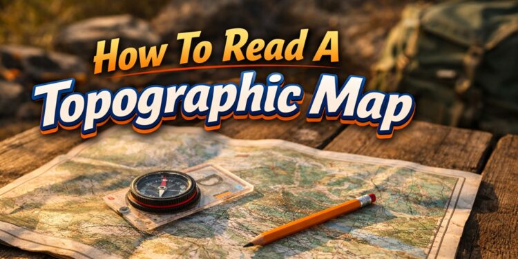
Your GPS battery is dead. The cell signal is gone. The trail you were following disappeared two miles back. What you have left is a folded paper map and a compass. That is the moment when knowing how to read a topographic map stops being a hobby skill and becomes a survival skill.
Topographic maps, often called topo maps, show the three-dimensional shape of terrain on a two-dimensional surface. They tell you not just where things are, but how steep the ground is, where the water flows, and what lies over the next ridge. For preppers, hikers, hunters, and anyone who takes wilderness survival seriously, reading a topo map is a fundamental competency that no technology can fully replace.
This guide walks you through every element of a topographic map in plain language, from contour lines to map symbols to real-world navigation techniques. By the end, you will be able to pick up any USGS 7.5-minute quad map and make sense of what the terrain is telling you.
What Is a Topographic Map?
A topographic map is a scaled representation of the earth’s surface that uses contour lines to illustrate elevation and terrain shape. Unlike a standard road map, which shows flat geography, a topo map communicates the vertical dimension of the landscape.
The United States Geological Survey (USGS) produces the most widely used topo maps in the United States. Their 7.5-minute quadrangle series (commonly called quad maps) covers the entire country in detailed sheets, each covering roughly 6 by 9 miles depending on latitude. You can download them for free from the USGS National Map or purchase printed copies from outdoor retailers.
Military topo maps use the same core concepts and are also available through government sources. The skills transfer directly.
Understanding Map Scale
Scale is the ratio between a distance on the map and the actual distance on the ground. It is one of the first things to check before using any map.
On a 1:24,000 scale map, which is the standard for USGS 7.5-minute quads, one inch on the map equals 24,000 inches on the ground, which works out to approximately 2,000 feet or about 0.38 miles. This is a large-scale map in cartographic terms, meaning it covers a small area in high detail.
A 1:100,000 scale map covers far more ground per sheet but loses detail. A 1:250,000 scale map is useful for planning a route across a broad region but is too generalized for navigating technical terrain.
Most topo maps include a graphic scale bar at the bottom margin. This bar shows a physical ruler comparison so you can measure distances even if you have forgotten the ratio. It also includes miles, feet, and kilometers to cover different measurement preferences.
To measure a straight-line distance, hold the edge of a piece of paper between two points, mark the distance, then compare that mark against the scale bar. For winding trails or roads, you can walk the paper edge along the route in short segments and accumulate the total.
Reading Contour Lines
Contour lines are the defining feature of a topographic map. Every contour line connects points of equal elevation. If you were to walk along a single contour line across the real landscape, you would never go uphill or downhill.
Contour Interval
The contour interval is the elevation difference between adjacent contour lines. On a 1:24,000 USGS quad map, the standard contour interval is 40 feet in most terrain, though maps of flatter regions may use 10 or 20 feet. The contour interval is printed in the map legend, usually near the scale bar.
If you count five contour lines going uphill, and the interval is 40 feet, you have climbed 200 feet of elevation.
Index Contours
Every fifth contour line is drawn thicker and darker than the rest. These are called index contours and they are labeled with their elevation in feet or meters. Index contours are the anchor points that allow you to figure out the elevation of any unlabeled line by counting up or down from the nearest index.
Interpreting the Shape of Contour Lines
The spacing and shape of contour lines reveal the character of the terrain:
- Close contour lines indicate steep terrain. The closer together they are, the more abrupt the slope. Cliffs show contour lines that nearly merge or actually touch.
- Wide spacing means gentle, gradual slopes or flat ground.
- V-shapes pointing uphill (toward higher elevation numbers) indicate valleys, ravines, or stream channels. Water always flows down the center of the V, away from the point.
- V-shapes pointing downhill indicate ridges or spurs that protrude from a hillside.
- Closed circles represent hilltops or summits. A depression (a low point surrounded by higher ground) is shown with hachure marks, which are small tick marks on the inside of the circle pointing toward the depression.
- Concentric closed circles represent a mountain or prominent hill, with the innermost circle being the highest point.
According to the USGS, understanding contour line shapes is the single most important skill for interpreting topographic maps in field navigation. See the USGS Topographic Map Symbols guide at pubs.usgs.gov for a complete reference.
Map Colors and What They Mean
Standard USGS topographic maps use a consistent color system that lets you interpret the landscape quickly once you know the code.
- Brown: All contour lines and elevation features.
- Blue: Water features, including rivers, lakes, marshes, springs, and seasonal streams. Dashed blue lines indicate intermittent streams that only flow part of the year.
- Green: Vegetation, specifically areas of dense tree or shrub cover. Open ground, meadows, and bare terrain are left white.
- Black: Human-made features, including roads, trails, buildings, railroads, and survey markers.
- Red: Major roads and land grid lines, including township and range boundaries.
- White: Open ground without significant vegetation cover, such as grassland, tundra, or desert.
- Purple: Revisions added to an older map using aerial photography without full field verification. This is a flag that features in purple may not be perfectly accurate.
Understanding Map Symbols
Beyond color, topographic maps use standardized symbols to represent specific features. The legend printed in the map margin is your reference, but most symbols follow consistent conventions across USGS maps.
Water Features
- A solid blue line is a perennial stream, flowing year-round.
- A dashed or dotted blue line is an intermittent stream, flowing seasonally.
- Blue shading or hatching marks marshes or swamps.
- A blue outline with white interior is an open water body such as a lake or pond.
Terrain and Land Features
- Triangles with an elevation number mark summits or benchmarks.
- The letters BM followed by a number indicate a benchmark, a precisely surveyed elevation point.
- Mine shafts and tunnels are indicated by specific symbols in the black layer.
Human Infrastructure
- Double lines indicate improved roads, with the fill color indicating class.
- Single lines with tick marks indicate trails.
- Small black squares or rectangles indicate buildings.
- Cemeteries, campgrounds, and picnic areas each have their own recognized symbols.
Carry a printed copy of the USGS symbol reference in your map case or navigation kit. It covers over 100 standardized symbols and is available as a free download from the USGS publications page.
Declination and Orienting Your Map
This is where a large percentage of people make their first serious navigation error, and it can send you miles in the wrong direction.
A topographic map is printed with true north at the top. Your compass, however, points to magnetic north, which is a different location from true north. The angular difference between the two is called magnetic declination, and it varies by location and changes slowly over time.
In the western United States, magnetic north is generally east of true north, meaning a compass pointed at magnetic north is actually pointing slightly to the right of the map’s north. In the eastern United States, the opposite is typically true. Some regions, particularly in the Pacific Northwest, see declinations of 15 to 20 degrees, which is enough to send you significantly off course over a long route.
The declination diagram is printed in the map margin of USGS quad maps. It shows the relationship between true north, magnetic north, and grid north with labeled angles. Use this diagram to adjust your compass bearing before navigating.
To correct for declination when traveling from map to field, add east declination to your map bearing or subtract west declination depending on your region and which direction you are converting. When in doubt, use an app or lookup tool to find the current declination for your specific location, since the printed value may be years old. The National Oceanic and Atmospheric Administration provides a free declination calculator at ngdc.noaa.gov.
How to Orient Your Map in the Field
Orienting a map means aligning it so that the map’s north matches the compass direction of north in the real world. When your map is properly oriented, features you see on the landscape will correspond to their correct positions on the paper.
To orient your map using a compass, place the compass on the map with the direction-of-travel arrow pointing toward the top of the map. Rotate the map and compass together until the compass needle aligns with the magnetic declination-adjusted north on your compass housing. The map is now oriented.
You can also orient a map by terrain association without a compass. Identify two or more landmarks that you can see from your position, such as a ridgeline, a river bend, or a hilltop. Find the corresponding features on the map. Rotate the map until those features on the map align with their positions in the real world relative to your location. This method works well in open terrain with distinct landmarks.
Identifying Your Location on the Map
Knowing how to find yourself on a topo map is the foundation of all navigation. There are several methods, and experienced navigators use them in combination.
Dead Reckoning
If you know your starting point and have been tracking direction and distance traveled, you can estimate your current location by plotting movement from the last known point. This is the baseline method and accumulates error over time, so it should be recalibrated whenever you pass a known landmark.
Terrain Association
Compare what you see on the ground around you to the map. Are you on a ridge? In a valley? Near a stream? How steep is the slope? What direction does the ground fall away from you? By matching these observations to the map’s contour patterns, you can often identify your location within a reasonable area without any instruments.
Triangulation
Take a compass bearing to two or more identifiable landmarks whose positions you can find on the map. Draw lines from each landmark back along the back-bearing. Your position is at or near the intersection of those lines. This is the most accurate method for pinpointing your location when landmarks are visible.
Reading Terrain for Route Planning
One of the most practical skills in topo map reading is using the map to plan a route before you set foot in the field. This lets you anticipate obstacles, find water sources, choose defendable campsites, and estimate travel time.
Identifying Water Sources
Blue lines and symbols indicate water. Look for streams at the bottom of V-shaped contour patterns. In arid terrain, learn to identify seasonal versus perennial water by the line style. Never assume a water source is present without field verification, particularly in dry seasons.
Finding High Ground and Defensible Positions
Closed concentric contour rings identify high points. A hilltop or ridgeline offers observation advantage, natural drainage away from your position, and often wind exposure that reduces insects and wet conditions. Topo maps let you identify these positions from miles away before you hike toward them.
Estimating Hiking Time
A common planning rule used in mountaineering is Naismith’s Rule: allow one hour for every 3 miles of horizontal distance plus one hour for every 2,000 feet of elevation gain. This is a rough estimate and does not account for terrain obstacles, pack weight, or physical condition, but it provides a usable baseline for planning shelter arrival before dark.
Identifying Avalanche and Flash Flood Risk
Steep, open slopes above tree line with broad, bowl-shaped contour patterns are prime avalanche terrain. Deep, narrow canyon-like V-patterns with steep surrounding walls indicate flash flood risk during heavy rain. Both hazards can be anticipated by reading the map before you enter the terrain.
Practical Navigation Exercises
Map reading is a perishable skill. The gap between understanding the concepts and executing them under pressure is closed only by repetition in the field.
- Download a USGS quad map for an area near your home and study the terrain before visiting it. Then go out, orient the map, identify your position, and check how accurately the map predicted what you see.
- Practice triangulation at a park or trail system where you can identify prominent landmarks. Take bearings to three landmarks and see how closely the intersection matches your known position.
- Plan an off-trail route using only the topo map. Choose waypoints, estimate distance and elevation change, and then hike the route while comparing your predictions to the actual terrain.
- Time yourself over a known section of trail to calibrate Naismith’s Rule against your personal pace. Most people will find they need to adjust the formula based on their fitness level and typical load.
The Federal Emergency Management Agency recommends that individuals and families prepared for disaster scenarios include paper maps of their local area in their preparedness kits, specifically because digital navigation fails during infrastructure disruptions. See FEMA’s preparedness guidance at ready.gov/kit.
Essential Gear for Map Navigation
A quality map and compass setup does not need to be expensive, but it does need to be reliable.
- Baseplate compass: A clear-baseplate compass with a rotating bezel, direction-of-travel arrow, and declination adjustment is the standard for land navigation. Brands like Suunto and Silva produce durable models that will last decades with basic care.
- Map case or waterproof cover: A folded paper map degrades quickly in rain or sweat. Keep it in a clear waterproof pouch or laminate critical sections.
- Pencil and straight edge: For marking routes, plotting bearings, and noting waypoints. Use pencil, not pen, so markings can be erased and the map reused.
- Pace counter: A knotted length of cord or commercially made bead counter helps you track distance traveled by dead reckoning.
- Map of your local area: Store a printed topo map of your most likely bug-out routes and surrounding terrain in your vehicle, home kit, and go-bag. Do not rely solely on downloaded digital copies that require a charged device.
Common Mistakes Beginners Make
Most navigation errors in the field can be traced back to a small set of predictable mistakes.
- Ignoring declination: This single error causes more search-and-rescue callouts than almost any other navigation mistake. Always check and apply declination before using a compass bearing.
- Misreading the contour interval: Not every topo map uses a 40-foot interval. Check the legend before you start counting lines or you will consistently underestimate slope and elevation gain.
- Trusting the map over the terrain: Maps are not always perfectly accurate, particularly in areas that have changed due to logging, development, or erosion. When the terrain clearly contradicts the map, trust what you can see and update your position accordingly.
- Holding the map flat without orienting it: Reading an unoriented map is a common source of wrong turns. Always orient your map to north before trying to correlate features.
- Underestimating elevation gain: Flat distance looks the same on a map whether it crosses a ridge or a valley floor. Always check contour patterns before committing to a route and budget extra time and energy for significant vertical gain.
Remember This!
Navigation skills can get you through the wilderness, but navigation alone will not feed you.
A topographic map helps you understand the land: where water flows, where valleys collect resources, where sunlight reaches edible plants, and where natural shelter and food sources are most likely to be found. But when the supply chain breaks down or a trip takes longer than expected, knowing what you can safely eat from the wild becomes just as critical as knowing where you are.
For thousands of years, people survived not because they had GPS or packaged food, but because they understood the land deeply enough to read both terrain and plants.
The Forager’s Guide To Wild Foods shows you exactly how to identify edible plants, medicinal herbs, and wild food sources that grow naturally across North America. It teaches you how to recognize nutrient-dense plants in the environments topographic maps help you locate: valleys with moisture-loving species, sunny clearings rich in edible greens, forest edges full of berries, and stream corridors where survival foods are often abundant.
Inside The Forager’s Guide To Wild Foods, you will discover:
- How to identify common edible plants in multiple seasons
- Wild foods rich in calories, vitamins, and survival nutrition
- Medicinal plants traditionally used for immune support and inflammation
- Clear photos that help prevent dangerous misidentification
- Where these plants typically grow based on terrain and environment
- How to harvest responsibly and sustainably
- Why many “weeds” are actually highly nutritious survival foods
- The wild edibles most commonly overlooked by beginners
A topo map helps you reach the right terrain.
Foraging knowledge helps you use that terrain to survive.
Together, these skills create real self-reliance, the ability to navigate unfamiliar ground and still find food even when modern systems fail.
If you are serious about preparedness, bushcraft, hiking, or long-term self-sufficiency, this is one of the most practical references you can own.
Discover edible plants hiding in plain sight and build a skillset that works even when technology does not!
The Forager’s Guide To Wild Foods helps you turn knowledge of the land into real-world resilience. 🌿
Final Thoughts
A topographic map is not just a navigation tool. It is a way of reading the land. Every ridge, every drainage, every saddle and summit is encoded in those brown lines. The more time you spend with a topo map in hand comparing what you see on paper to what exists in the real world, the faster your terrain reading becomes instinctive.
When the grid goes down, the satellites go dark, or you simply find yourself somewhere your device cannot help you, a paper map and a compass are the tools that will get you home. Invest the time now to build this skill while the stakes are low.
Pull up the USGS National Map, download the quad sheet for your local area, and start studying it today.
You may also like:
 2026 Natural Disaster Map. Is Your Area on the List?
The Only 3 Shelters You’ll Need to Survive when SHTF (VIDEO)
2026 U.S. Earthquake Map. Is Your State in the Danger Zone?
Join The Ask A Prepper WhatsApp Channel For Weekly Prepper Knowledge And Tips


